- 2020
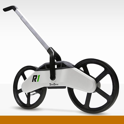
The DCI TeraTrak R1 is a real-time terrain-mapping tool for horizontal directional drilling. It provides accurate and continuous topography data and the location of utilities and waypoints at all stages of the drilling process, which previously required expensive survey methods. Used in conjunction with the TeraTrak app, the R1 visualizes underground hazards and the precise elevation and distance measurements along the drill path. It streamlines the planning for job site boring, making it more accurate, efficient, cost effective, and accessible. As the ground is becoming increasingly crowded with utilities, the TeraTrak R1 makes it far less likely that the drill crew will run into underground hazards.
Designed by: Digital Control Inc. and Tactile Design Teams